
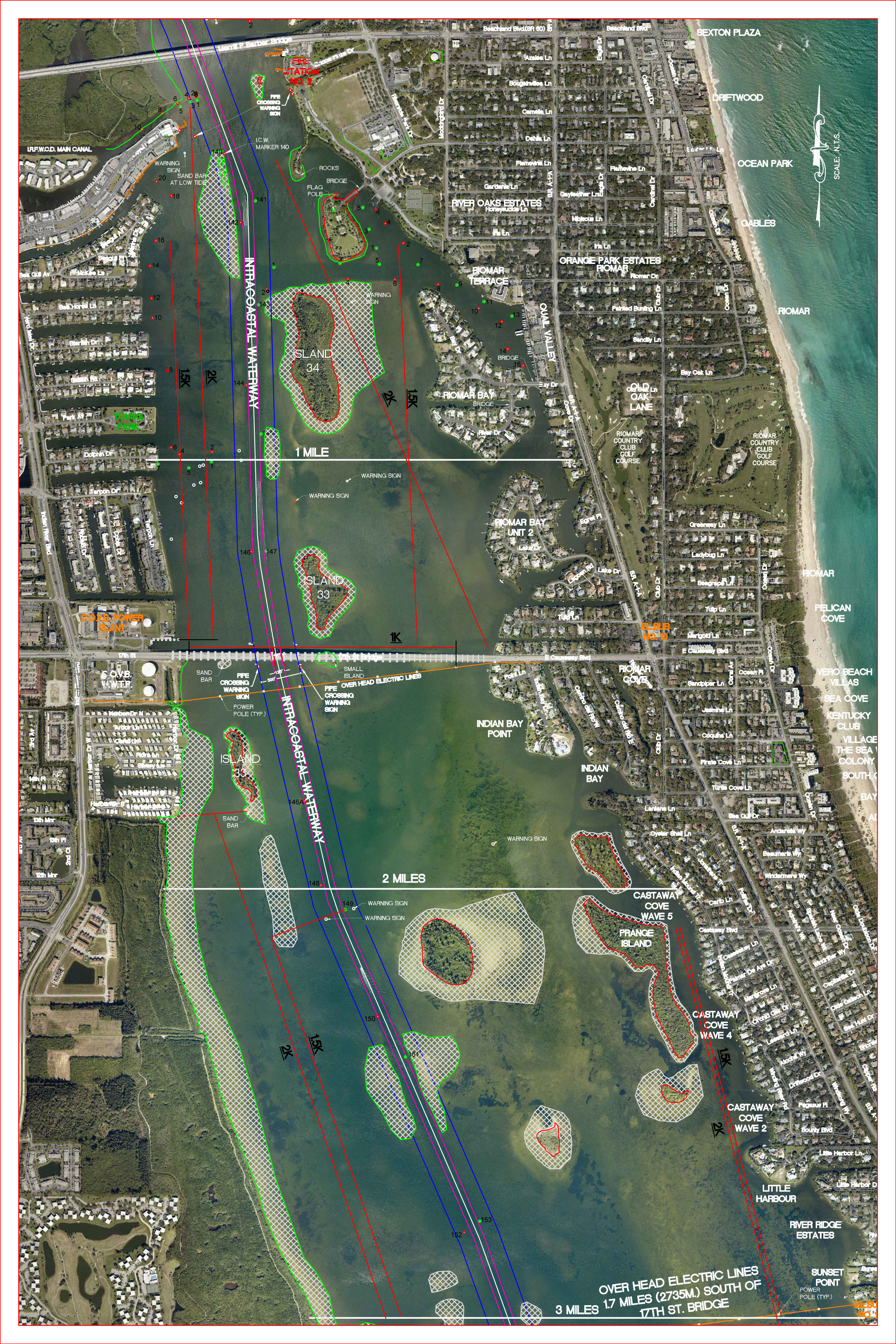
Below you will find Aerial Maps of the Indian River that surrounds our facility from North to South.
On the maps you will find courses, low spots, and other hazard areas.
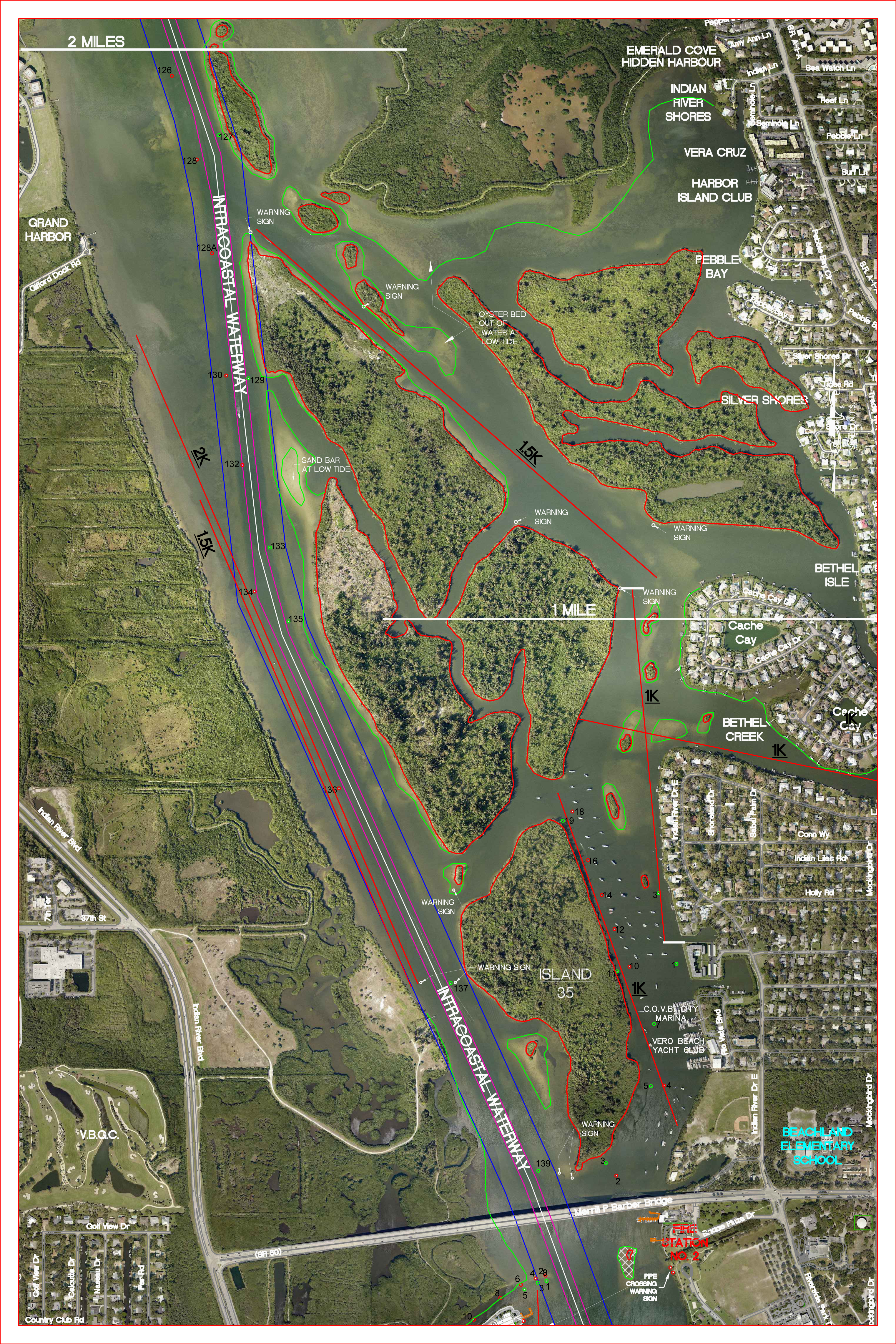
River Map — North — 2 Miles
(Click on map to view high-resolution image)

River Map — North — 2-4 Miles
(Click on map to view high-resolution image)
River Map — South — 3 Miles
(Click on map to view high-resolution image)
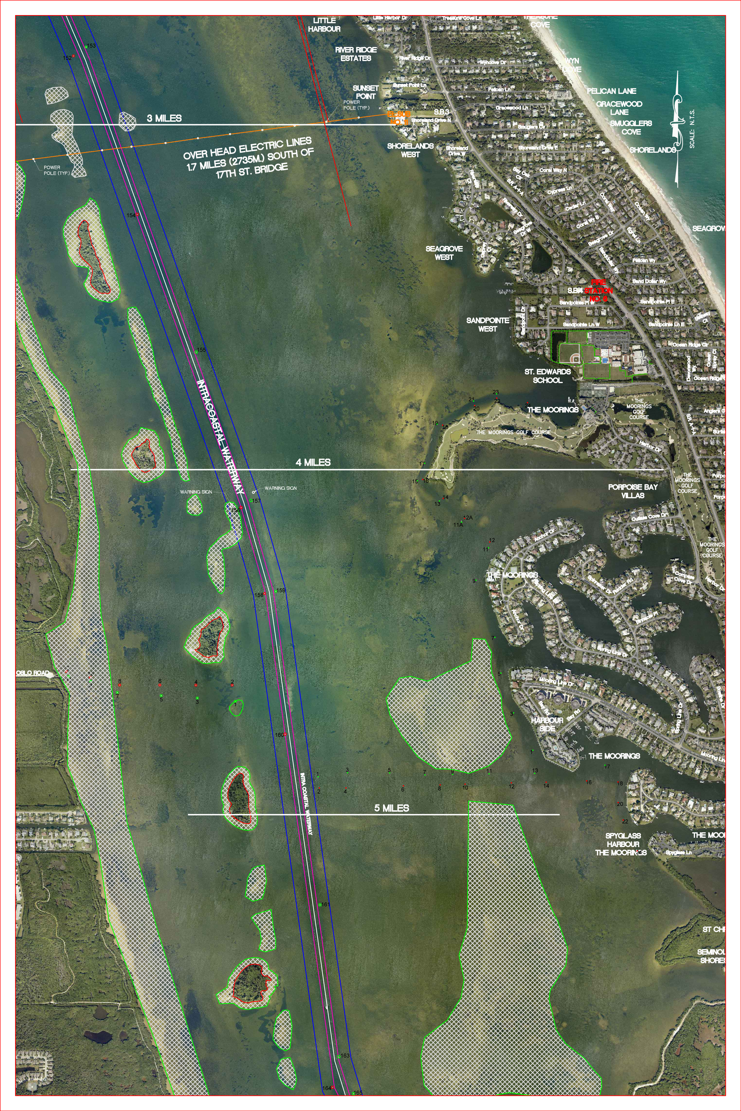
River Map — South — 3-5 Miles
(Click on map to view high-resolution image)